Tough, wet, rainy, sunny, adventurous, grueling and epic are all good words to describe this trip to the high passes of the Himalayan range where 10 of the world’s 15 tallest mountains lie. Trekking through rhododendron forests, around lakes and ending up at the top of the world at over 5km above sea level to places where only few people have ever set foot on was definitely an epic experience of a lifetime for both Kevin and Beer. For a week and a half, the two covered over 150km in distance, ascended over 2.5km vertically on foot, crossed 5 high passes and finished the journey on a high note feeling stronger (both physically and mentally), spiritualised, proud and extremely satisfied. Needless to say, such once in a life time experience - one that dwarves anything else we have ever done - will be locked in our memories for a long time, if not for the rest of our lives.
How we ended up in the Himalayas:
Kevin: Earlier this year, I thought that it would be great to go on a holiday and hang out somewhere nice with Beer, an old friend back from boarding school days.
Beer: The idea crossed my mind that we should be doing something memorable… something epic... while we still can.
Kevin: We considered cycling across Japan, doing Everest Base camp, trekking to Macchu Piccu and even crossing the Gobi Desert in Mongolia, but after considering various factors including weather, timing, and logistics, a trek in Bhutan seemed to be our best option.
Beer: After a few email exchanges with a number of trekking companies (including the one we used - Bhutan Travelers), we got what we thought was a pretty clear idea - that the Chomolhari Trek was the thing to do. Indeed, as we later found out, it did not disappoint in terms of “epicness”... In fact, I think I got more than what I asked for!
Introduction to Bhutan:
Geographically located between Tibet, India and China, Bhutan is a tiny kingdom tucked away as one of the most untouched and undeveloped countries of the world.
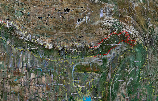
Courtesy of Google Earth
Beer: Despite having an extensive history, not many people know much about Bhutan itself, or even where it is in the world (us included!)... and thankfully we went there while it still has a low profile.
Kevin: We felt it was a good opportunity for us to learn first hand what the country was all about. We also learned that Bhutan’s government have decided to up its tourist fee (currently at USD210 a day) to USD250 a day to prevent big waves of tourists flooding into the country - the new fee will come into force quite soon apparently.
Unfortunately there is little documented information of Bhutan’s history as there have been many fires and civil disputes which have left many of the country’s historical documentation lost or destroyed. However, according to stories passed on from generations, the country was originally part of Tibet and subsequently part of North India.
Beer: In the 10th century, Bhutan became an independent country comprised of several smaller kingdoms.
Kevin: Shabrung Ngawang Namgyal was responsible for unifying the country in the 17th century to what is currently known as Bhutan.
Beer: Shabrung’s body has been preserved in an inner chamber in the Punakha Dzong since his death and only 2 high priests (lamas) have access to this chamber.
Kevin: This chamber is considered to be one of the holiest places in all of Bhutan and not even the King of Bhutan is allowed into this chamber.
Beer: In 1907, the monarchy was established and since then there have been five kings
Kevin: The 4th king has since set Bhutan on a path for democracy by establishing a council of ministers in 1999 and subsequently a lower and upper house in 2007.
Trekking:
“Trekking is a form of hiking, a multi-day, often arduous hike especially in mountainous regions”
- Wikipedia
During our research, we found that there are a number of treks which can be done in Bhutan, the more popular ones being:
- Druk Path
- Bumthang Trek
- Chomolhari Trek
- Laya-Gasa Trek
- Snowman/Lunana Trek
As this was our first time trekking, we wanted to do something which is realistic for beginners and yet challenging and the Chomolhari trek seemed to fit the bill as it is usually noted as “moderate to demanding” in many trekking guides/books. The Snowman trek is often cited as being the most difficult trek in the world, covering a staggering 11 or more high passes over the course of 24-31 days.
To cater to more amateurish trekkers such as ourselves, our trek company Bhutan Travelers suggested an itinerary of 14 days in total which includes a few days of sightseeing and a trek which covers about 150km, and 2 high passes up to 4,950m. We were told that the temperatures would vary from about 5 to 25 degrees Celsius during the trek.
Definitely fits the definition of a trekking then!
To give a perspective as to how high up we were, Mt. Kilimanjaro (the highest point in Africa) is at about 5,890m, Mt. McKinley (the highest point in the USA) is at about 6,190m, Mt. Elbrus (the highest point in Europe) sits at about 5,642m and the highest point in the Alps is only 4,808m - that being the peak of Mt. Blanc. This is compared to the 5,000 odd meters we traversed!
Preparation:
Kevin: I definitely expected there to be some training to be done and spent the 2-3 weeks prior to the trip doing stair climbs and building up my leg muscles and knee strength.
Beer: I did no training whatsoever due to the work I had to sort out before going on this epic trek. I relied on the fact that I play football once a week and hoped that my body will be in good enough shape for this.
Neither of us was mentally prepared for what was to come though...
Kevin: I picked up most of my trekking gear in Singapore, making 10-15 trips to ensure I had picked up everything that I needed. I also went to Covent Garden in London which had some decent items like the sleeping bag, trekking shoes and Gore-tex gear.
Beer: Definitely an expensive part of the trip! I virtually picked up everything from the North Face shop in Siam Discovery, Bangkok.
Kevin: Beer might as well have been sponsored by North Face!
Each of us spent close to US$1,500-2,000 on gear alone. This included base layers for trekking, shoes, sleeping bags, duffel/daybags, medicine and Gore-Tex jackets/pants. That brought the total for the trip to close to US$7,000 per person for everything, but we comforted ourselves in thinking that about US$70 per day goes towards improving Bhutanese education and health.
Our 14 day adventure of the Himalayan Kingdom of Bhutan, considered to be the last Shangri-La on earth, consists of trekking approximately 170km in total along un-spoilt paths which few people have ever walked, camping in valleys as high as 4,650m and traversing 5 high passes to over 5,000m. Considering such facts, our journey is comparable to, if not more difficult than, the Everest Base Camp trek.
The Bhutanese consider their mountains to be extremely sacred and because of this, the country is also home to the highest unclimbed peak in the world (Gangkhar Puensum at 7,570m).
Trip Itinerary:
Day | Location | Distance (km) | Altitude (m) |
1 | Bangkok – Paro | 2500 | |
2 | Paro – Hike to Taktsang Monastery (Tiger’s Nest) | 14 | 3150 |
3 | Paro – Shana | 18 | 2870 |
4 | Shana – Sio Thangthangkha | 22 | 3600 |
5 | Sio Thangthangkha – Jangothang (Chomolhari Base Camp) | 20 | 4050 |
6 | Jangothang – Hike to Tshophu Lake | 15 | 4390 |
7 | Jangothang – Lingshi (via Nyeli La) | 22 | 5050 |
8 | Lingshi – Babjee-Thang Valley (via Nachuing La double pass) | 17 | 5080 |
9 | Babjee-Thang Valley – Dhumzo Chhu Valley - Soi Yakse (via Bonte La) | 20 | 4920 |
10 | Soi Yakse – Gunitsawa (via Taglung La and Thombu La) | 18 | 4480 |
11 | Gunitsawa – Drukgyel Dzong - Thiumpu | 15 | 2850 |
12 | Thiumpu - Punakha | 2320 | |
13 | Punakha – Paro | 2500 | |
14 | Paro - Bangkok | 2500 |
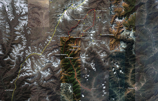
Trek Path - courtesy of Google Earth
All video and photos were taken with:
- JVC Everio GZ-MG70AG hard disk camcorder
- Nikon D80
- 18-200mm (f/3.5-5.6) AF-S VR DX lens
- Canon EOS400D
- 10-22mm (f/3.5-4.5) EF-S USM lens
- 18-55mm (f/3.5-5.6) EF-S lens
- 55-250mm (f/4-5.6) EF-S IS lens
Day 1: Paro:
There are only two ways to fly into Paro – the first being from Kathmandu (Nepal), through Delhi (India), and the other being from Bangkok (Thailand) through Calcultta (India) or Dhaka (Bangladesh).
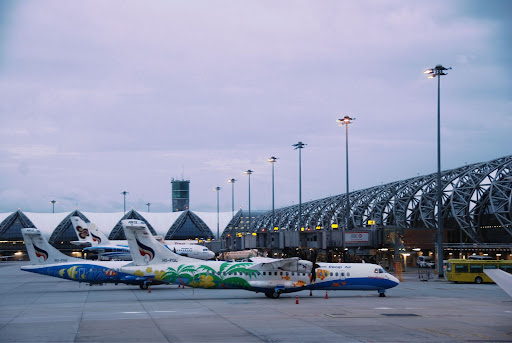
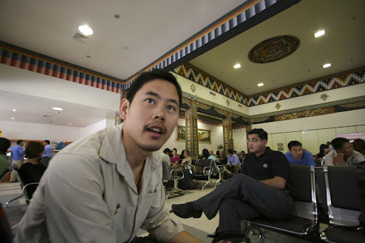
Bangkok Suvarnbhumi Airport at Dawn
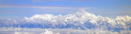
The Everest Mountain Range
Paro Airport
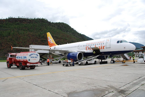
Paro Airport
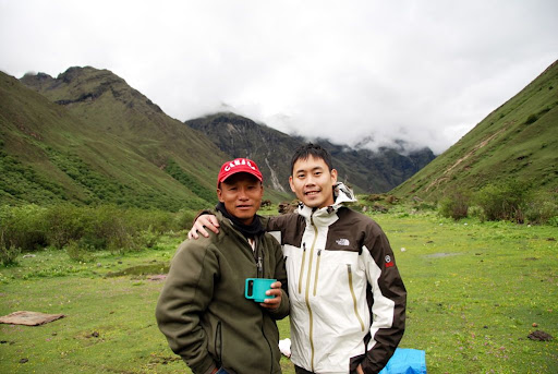
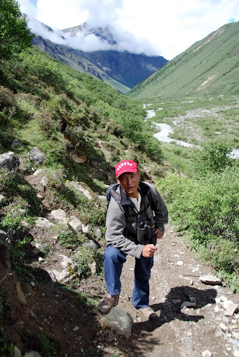
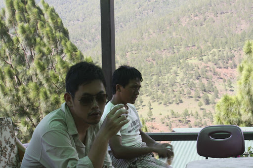
Beer: Our guide Chenda is 35 years old, married with 2 boys (aged 5 and 8). He took care of us for the entire duration of the trip.
Kevin: Based in Paro, he has a good 5 years experience as a guide, having covered 18 out of the 20 provinces in Bhutan including a large number of trek tours in the region.
Beer: Leki is 25 years old and comes from the Eastern part of Bhutan (with traditions like the “night hunting”, I would say it’s the more interesting part of Bhutan - I’m sure Kevin would agree ;) ). A quiet but sound driver, he drove us for a total of 3 days on the trip. I was quite surprised that Chenda speaks very good English and even more so when I learned that most Bhutanese can speak it as it is the mode of teaching in the schools.
Kevin: It was definitely interesting to see how common English was used considered how reserved and conservative Bhutan is.
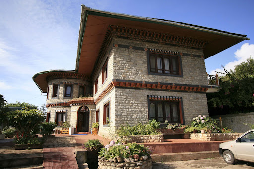
From the airport, it took us 15 minutes to get to our hotel – the Samden Norzin a 3-4* hotel located right at the top of Paro’s main street. The hotel had decent sized clean rooms and because of the low season, it seemed as though we were the only guests staying! Typically, June is considered to be the start of the monsoon season and the peak of the tourist season is usually April – May and October – November of each year.
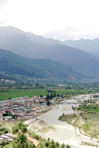
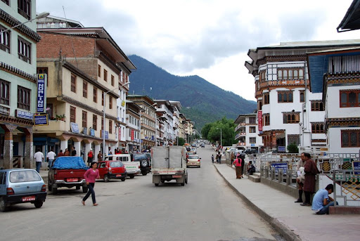
Our immediate impression was that this was one small city!
Beer: Make no mistake, Paro is very small. The main street is probably less than 500m long. Walking down the street, I felt like I was in a set from one of Hollywood’s studios... All the buildings were virtually the same in forms and colours.
Paro
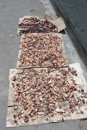
Beef being dried on the streets of Paro
After a quick refresh at the hotel we headed on our first sightseeing destination to Kyichu Lhakhang, a 7th century temple and one of the oldest temples in Bhutan driving along a scenic Paro Chhu (Paro River).
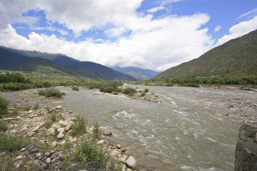
Paro Chhu (River)
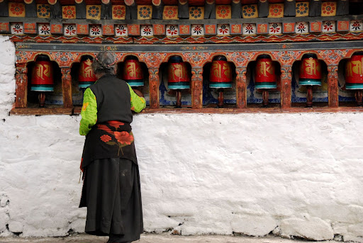
Old lady spinning prayer wheels inside Kyichu Lhakhang
The prayer wheel is a spindle of prayers and mantras used across Buddhism and placed at almost all Buddhist temples, dzongs, big piazzas - a very common sight. The wheels should be spun clockwise (in the direction that the prayers are written) and it is said that spinning the wheel effectively represents a person saying all the prayers encompassed in the wheel.
Before we knew it, it was lunch time. This time, we headed to the Travellers Restaurant in the center of Paro city and took in a hearty helping of Bhutanese dishes – most of which are symbolised by rich flavours and typically served with sweet rice. It was here we had our first taste of the national dish of Bhutan – Emadatse. A blend of chillis and cheese, the dish can only be described as a light Jalepeno cheese dish.
Kevin: Chillis are considered more of a vegetable in Bhutan and Bhutanese eat chillis regularly with all their meals
Beer: This was an extremely tasty dish which goes well with our usual rice complements. We loved it!
Following lunch, we made a quick stop at the Bhutan National Bank to exchange some of our USD for Bhutanese Ngultrums. Still developing, the bank’s transactions were literally done out of a suitcase full of money which was a somewhat amusing sight. We also ran into the first other group of tourists (aside from ourselves) in Bhutan – it looked as though they were only here for the cultural tours though.
Chenda: You two seem to have gotten the complements from the ladies at the bank!
Beer: I think the complements were mainly for me - no need to get excited Kevin (just kidding!)
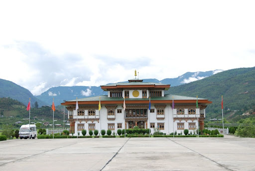
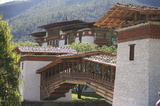
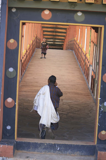
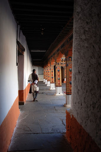
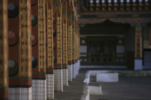
Rinpung Dzong, the largest structure in Paro was our next stop for the day which we had to change into something a little less casual for. Although the Dzong looks extremely close to the city, we actually had to drive around the mountain ridge and across a bridge to get to our destination. This Dzong housed both the monastic and administrative sections of Paro including the judicial department (like many other Dzongs in Bhutan).
Inside Rinpung Dzong
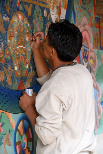
Painter maintaining one of the many wall paintings in Rinpung Dzong
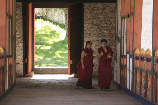
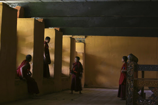
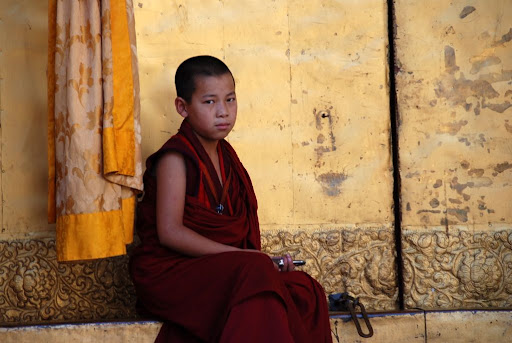
This was our first close encounter with the monastic training and upbringing of many of the monks in Bhutan. Often sent to the monasteries at the age of 5 or 6, the monks in training will sleep, eat and learn at the monasteries – most of which at least to the age of 18. According to Chenda, most of the monks don’t know what they are saying when they are praying... quite surprising really.
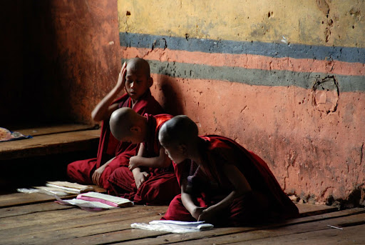
Monks Training in Rinpung Dzong
On the bridge just outside Rinpung Dzong
At the end of our tour we each received an enchanted string from a high monk to bless us with good luck.
Although we tried to stay from the modern inclinations of the internet, we both had a few things to sort out before we were completely cut off from the outside world. A visit to the internet café truly showed the stage of development which technology was moving at. When we got there, we were surrounded by high-tech colour laser printers, SD cards and other bits of modern technology for sale, but it turned out that internet was still on 56k dial-up which took a little getting used to. Charged at 2 Rupees/min (very cheap), we tried it out for 15 minutes or so but it soon became evident we weren’t going to get that much done at this rate.... considering how much work we got done, perhaps it’s not so cheap! (Beer: I certainly paid for almost nothing...)
Beer: I then suggested we should try something really Bhutanese.
Kevin: We were told of these dried blocks of cheese called chugo.
Beer: Chenda told us these were often left in the mouth for a good hour as they slowly dissolve.
Kevin: So we were a little bold and decided to buy a couple to try on the street. I can only describe it as tasteless dried blue cheese dried in some weird brine. I’m not sure why we didn’t really ask what it was before eating it.
Beer: It turned out that it was yak cheese which is boiled and then dried in the sun. Not very tasty at all! I only managed about 2 minutes before spitting it out! Mine was VERY moldy...
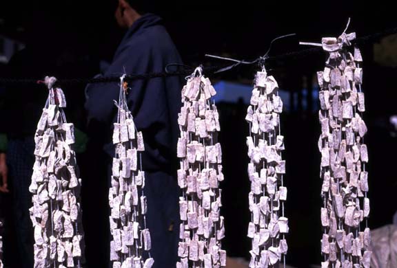
Chugo (Dried Yak Cheese) courtesy of www.theorientalcaravan.com
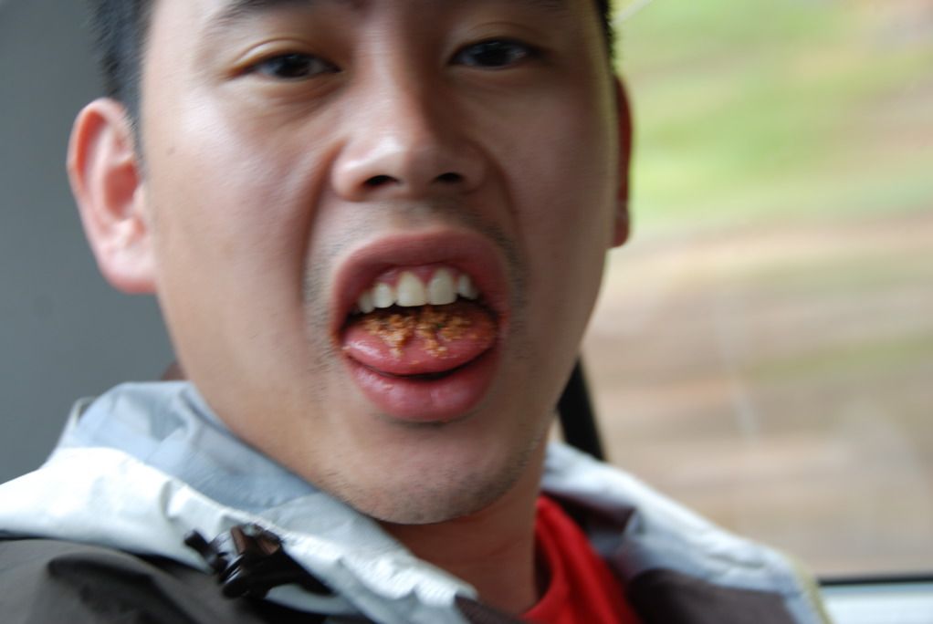
Beer chewing Betelnuts
Day 2: Hike to Taktsang Monastery (3,150m):
3.5 hours | 14km | Altitude gain 700m | Altitude loss 700m |
On our second day in Bhutan, we woke up at 7:30 a.m. for a quick 8 o’clock breakfast. Breakfast came in the form of toast and omelet and a bit of somewhat funky butter. Simple, high energy and a good representation of our morning meals to come for the remainder of the trip.
Soon after breakfast, we started on our 15 minute drive from our hotel to the base of Tiger’s Nest. From there, a ‘short’ 2 hour, 7km hike up to the symbolic holy landmark of Bhutan, Taktsang Goemba, also known as Tiger’s Nest Monastery. Situated at 3,150m on the edge of a cliff slightly North-West of Paro, Guru Rinpoche was said to have flown here on the back of a tigress to meditate inside a cave for 3 months – which is currently inside the monastery itself. The monastery was then built in 1692 and has been rebuilt a number of times after a series of fires said to have been caused by butter lamps. Taktsang has been off-limits to visitors until a few years ago but we have been fortunate enough to be able to visit one of the most sacred places in Bhutan.
Kevin: What we thought was to be a 2-3km hike to Tiger’s Nest ended up to be a 15km climb up the mountain!
Beer: The lack of mental preparation made this one of the hardest walks for a long long time! But a piece of cake compared to what were to come in the following 9 days or so... hahaha (now I can laugh).
Taken from the first viewpoint across from Taktsang

Taktsang Monastery from below

A sign written on A4 paper warning us of the dangers of landslides on the path
The views as we neared the first viewpoint and onto Tiger’s Nest were breathtaking and extremely enchanting – like none that we had encountered before. One of the most photographed locations in Bhutan, Taktsang is one of the epitomes of Bhutanese culture and religion.
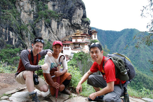
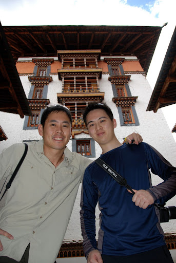
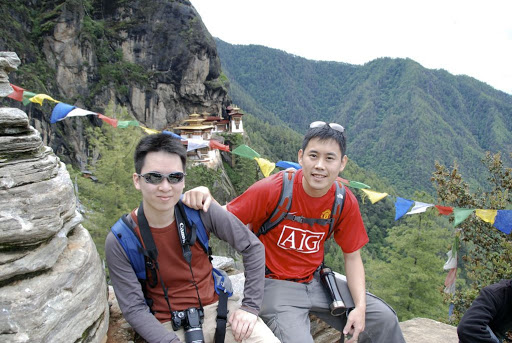
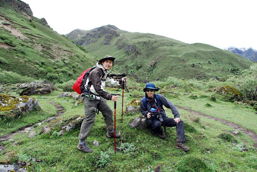
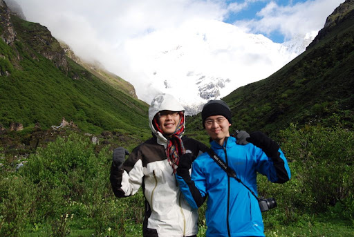
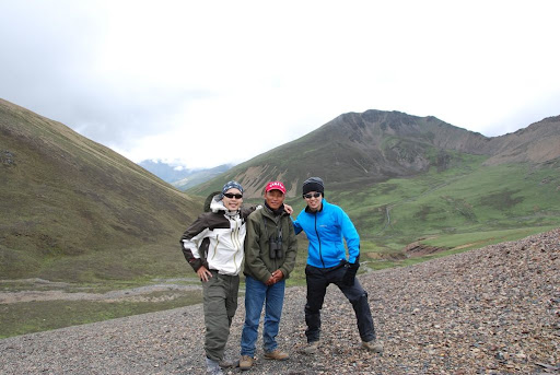
Kevin, Chenda and Beer at Taktsang Monastery
Kevin: As we approached the monastery, the sheer cliffs surrounded by high waterfalls and pure presence of Tiger’s Nest was truly surreal.
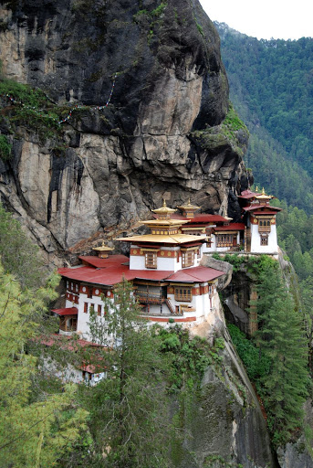
Taktsang Monastery
The trip back down was much quicker but it definitely tested Beer’s slightly dodgy back and knees as he had a bit of a tumble on one of the slopes down. Nonetheless, it was a good warm up for the days to come and we took a quick drive from the end point to the Yak Herders Restaurant to enjoy a much needed lunch.
We had intended to visit the museum the day previously but it had been closed, so after lunch and a short rest at the hotel, another drive around the valley and up the hill to Ta Dzong (situated just above Rinpung Dzong), a watch tower built in the early 1950s to guard against the attacks by the Tibetans and subsequently converted to the National Museum of Paro in 1967.
Kevin: It looked very small from the outside, but inside we found ourselves in an intricate maze showcasing collections of Bhutanese Thangkha murals/paintings and a historical accumulation of weapons, stamps and other odds and ends.
Beer: On the day we visited, the museum had its last show displaying the history of Bhutanese monarchy - beginning with King Gongsar Ugyen Wangchuck, which I thought was the highlight of the museum.
After 1.5 hours at the museum, we stepped outside into what was the start of some extremely dreary, rainy weather for the days to come.
Chenda and Leki looking on
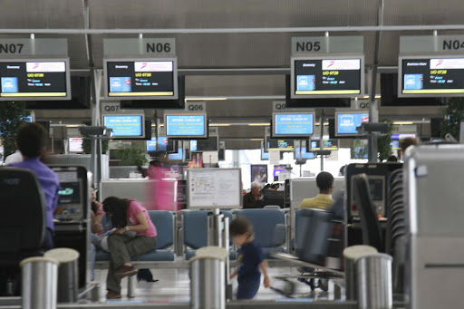
Paro Airport
6 hours | 18km | Altitude gain 300m | Altitude loss 0m |
Finally, the day we had been waiting for!
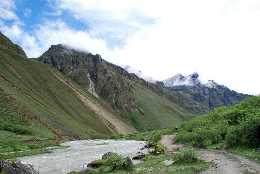
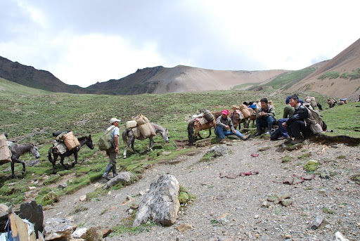
Three months of anticipation, excitement, planning and preparation had led up to our exciting first day on the trek. The skies had been overcast since we had arrived into Bhutan – Kevin was completely psyched whereas Beer was a tad skeptical of the impending rain. Our drive down to the start point of the trek took us down the same route as the previous day, past the airport, the Taktsang starting point and continued North-West for another 20 minutes or so to Drukgyel Dzong – a dzong built in 1646 by Shabdrung Ngawang Namgyal which burned down in 1951 and stands as the starting point for most treks in Paro.
Kevin: When we arrived at the start point, I was truly impressed at the logistics and planning which had gone on already.
Beer: In addition to our 9 horses, 5 people were working busily to get all the horses packed. That was when we first met our trek team.

Trek Startpoint
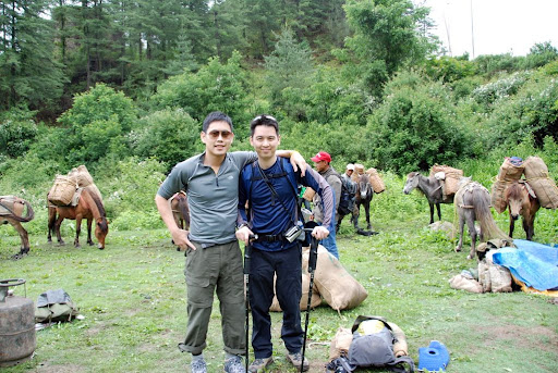
Trek Startpoint
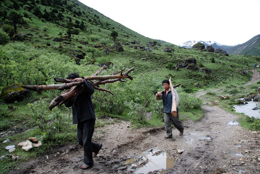
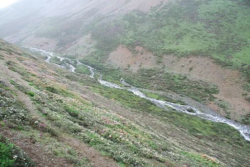
The first ten minutes was a pure downhill walk before climbing gently through rice fields, farm houses, wooden fences and eventually reaching a small village about an hour into the trek.
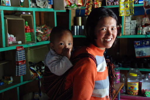
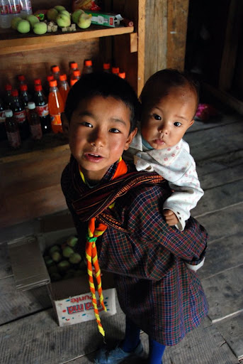
Village shopkeeper with her daughter
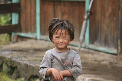
Girl in village
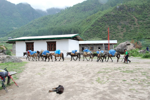
Our trekking crew and horses passing us at the village
Beer: Thank god Kevin got us those trekking poles. Without them I don’t know how I would walk in those muddy and rocky trails! (not to mention many small streams and water-logged patches.
This was the last trek for 19 year old Sangay before he heads off for college. He was a face we looked forward to seeing at one of the many tea breaks and lunches on the trek and was helped us out with pretty much everything.
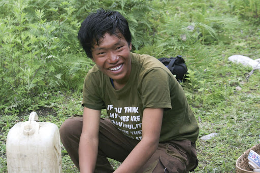
Sangay
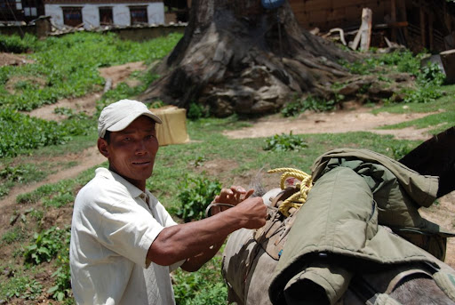
Gembo
Beer: My first thought at the camp site was “I hope the rain doesn’t continue like this!”.
Kevin: It was definitely a tiring day hiking through countless path undulations and getting to camp was a nice relief.
By the time we arrived at the camp site (about 4 p.m.), the rain died down quite a bit and it looked as though the Japanese pair had been there for hours. Had the weather been a little drier, it would have been nice to hang out with them at the camp.
Tea is usually served on our arrival at the camp site and usually help to boost some of the energy we lost during the day with some hot chocolate, tea and biscuits.
Tea time at camp site

Phuntsho
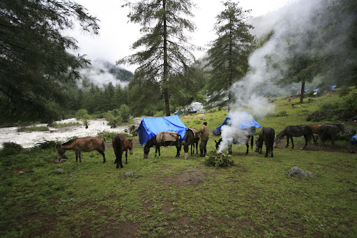
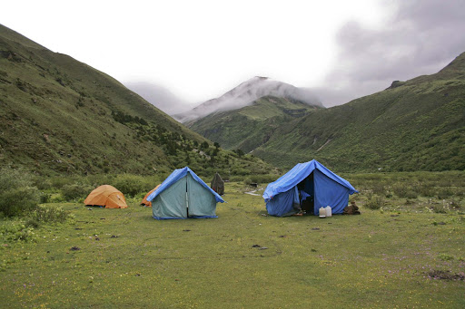
Campsite at Shana
With no showers, we resorted to quick wipe-downs with a bowl of warm water after dinner. Not that hygienic, but it would have to do for the next 9 days! Throughout the course of the trek, both Kevin and Beer thought of some slightly unorthodox ways to ensure cleanliness – including some unspeakable “full-body” scrubbing by Beer and the use of anti-bacterial wet-wipes by Kevin.
With a long day ahead tomorrow, it was lights out at 8:30 p.m. for us.
Day 4: Breakdown Day – Shana to Soi Thangthangkha (3,600m):
8 hours | 20km | Altitude gain 500m | Altitude loss 0m |
After a good night’s rest, we woke up to a drier day and the sun trying to fight through the overcast weather.
Beer: It took some getting used to, but we had a good rest and woke up to some dry weather, so my spirits got raised a bit.
Kevin: This was the day I was most worried about. Gaining 700m in a day is well above the recommended 300m and even though we were both taking Diamox (Acetazolamide) it was a big ascent.
*Diamox is a carbonic anhydrase inhibitor which can be used to treat a number of conditions, including Glaucoma, epilepsy and altitude sickness. We began taking Diamox prophylactically, the day before we began to help our bodies get adjusted to the altitudes we were going to. Side effects include tingling in fingers and toes and as it is a diuretic, increased urination.
A quick breakfast of eggs, toast and porridge later, we were ready to go at about 8 a.m. The Japanese pair had left half an hour earlier and we had intended to catch up with them during the day (which of course did not happen).
Nothing could have prepared us for the day ahead. Never-ending steep climbs followed by steep descents took us through pine tree forests and a few more muddy, stone-filled paths in what seemed to be perpetual rainfall. Even after four hours when we stopped for lunch by the side of the river after crossing one of the many bridges that day we were plagued by more rain and flies/gnats everywhere. It was definitely not pleasant, and the rest of the afternoon took us through even greater ascents and descents – something which Kevin was definitely struggling with. Beer’s fight was more with the rain, soggy clothes and endless wetness.
Admittedly, trekking is something we had never done before and no level of mental or physical preparation could have made this day much less difficult for either of us.
Kevin: By the end of the day, I was so physically and mentally drained and was not looking forward to having to do it all over again the next day.
Beer: I was close to going home by the end of the day. The rain would not let up and we could see nothing but trees and forest. Also, our clothes wouldn’t dry and it was generally a miserable day. When I got to the camp I rushed to my tent to get some cover but couldn’t get inside as quickly as I wanted as my shoes wouldn’t come off (my hands were numb and I was a little disturbed by the rain). Once I managed to take of my shoes I got inside and screamed and just sat there and did nothing for 10 minutes. Awful.
Technically a 700m climb, we must have climbed over 1,200m and descended about 500m altogether to get to the camp site at Soi Thangthangkha at around 3,600m. The last bridge to cross before getting to camp was a beautiful site and it was here that the rain really came down hard. Both of us retreated to our now individual tents to try and out-nap the rain… unsuccessfully.
Although only 2 days in, we asked each other “What did we get ourselves into?” and “What are we doing here?!” We questioned how mentally and physically prepared we actually were and both agreed that this was the toughest day either of us had endured.
Back in boarding school, our school had a tradition of the “50-mile walk”. Which was a beeline from Brighton in the South of England, through the South Downs (at a maximum elevation of just under 300m) and ending up back to our school in Surrey. Every year, about half the 120 odd people who start it drop out due to a variety of reasons and the fact that Kevin completed it in 13 hours at a half-jog speed and Beer soon after was considered to be pretty decent achievements. This was with bottles of water and extra shoes on our backs as well as chaffing and blisters for much of the way. However, nothing compares to this day’s trek.
We were very close to our breaking points…
Day 5: Chomolhari Base Camp – Soi Thangthangkha to Jangothang (4,050m):
8 hours | 20km | Altitude gain 450m | Altitude loss 0m |
Sleep had generally been reasonably good for the trek so far, especially as we were both so tired by the end of day and last night was no exception. Unfortunately we woke up to more of the beautiful rain…
On a clear day from the Thangthangkha campsite, it is possible get a glimpse of Mt. Chomolhari, but because of the perpetual downpour, all we saw were clouds and more rain.
Beer: At this point in time, I was running on fumes and my morale level was pretty close to 0 by now. I hated the fact that everything felt wet (even though they may be dry) and that I couldn’t hang anything to dry as the air was so moist.
Kevin: I had been fairly resilient to the rain so far, but waking up to it again made me question my judgment on choosing this time of year for doing the trek.
After our usual breakfast, Kevin set off a few minutes before everyone else given his slightly slower movements ascending; and today was no exception with an almost half km (vertical) ascent towards Chomolhari Base Camp a.k.a. Jangothang. After a steep ascent for 350m or so, we got our first views of the mountains albeit some of the lesser peaks of the Chomolhari range.
On the way to Jangothang
Beer and Kevin nearing Jangothang

Peaks on the way to Jangothang
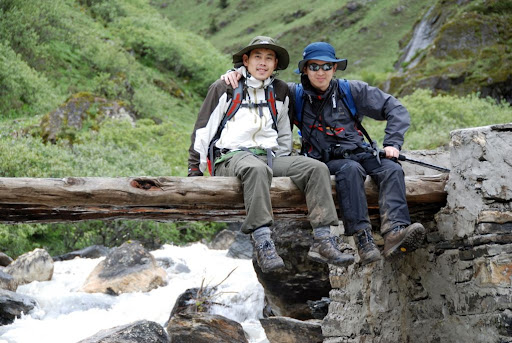
The final bridge before Jangothang
Beer: It was so cold and rainy that I felt like I was on the verge of falling into hypothermic shock. My clothes were wet (from rain/sweat), my socks were wet and I was shaking. I was going to call it al off had the weather carried on like that. Miraculously, the rain stopped and the sun came out to save the day!
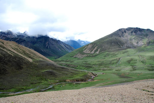
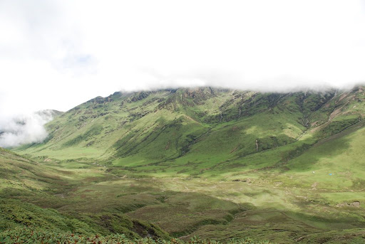
The rain had begun to die down quite a bit since the morning by then and we began to see some breathtaking views of the smaller mountains as we made our way up the valley towards Jangothang. The towering peaks with waterfalls coming from the tips were definitely an inspiring sight, even in the dreary weather.
On the way to Jangothang
On the way to Jangothang
Almost prophetically, the sun began its arduous trip from behind the clouds a little after we hit the camp site.
Settling into base camp
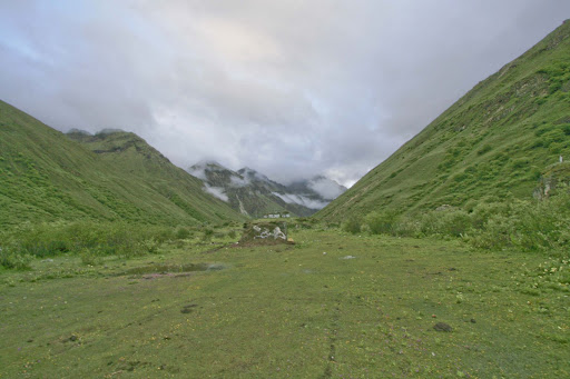
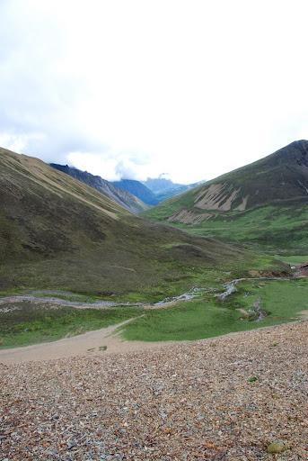
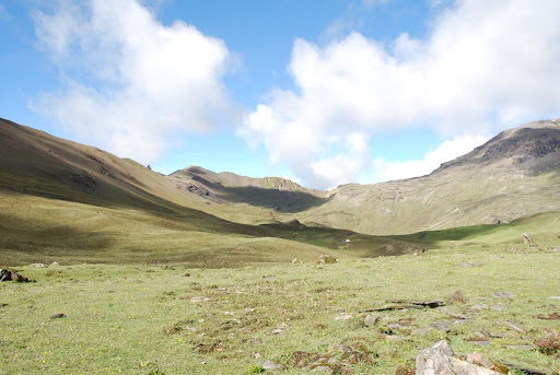
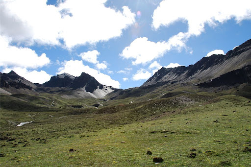
View from camp site looking North towards Lingshi
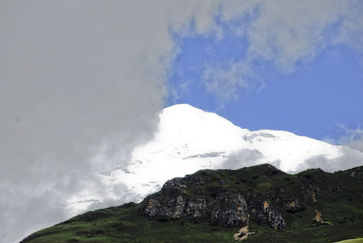
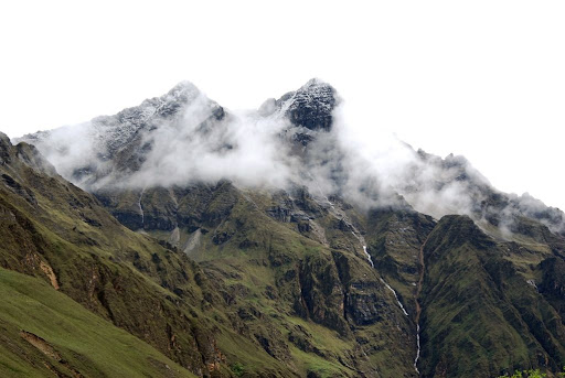
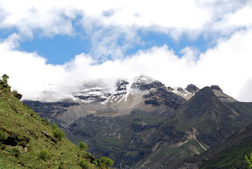
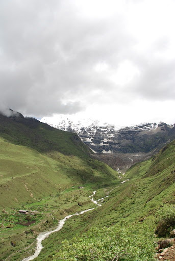
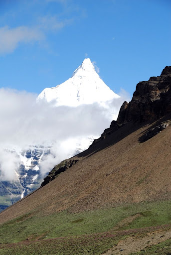
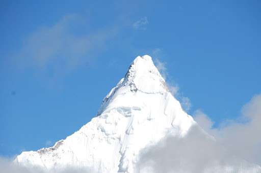
View of Chomolhari
View of Chomolhari
View from campsite towards the South
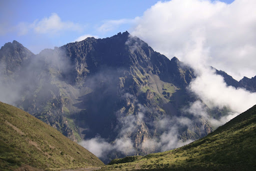
Chomolhari is often called the “Bride of Kangchenjunga” (the 3rd highest mountain in the world sitting in the Everest range). Sitting on the border of Tibet and Bhutan, Chomolhari was first climbed in 1937 by a 5-man British expedition and subsequently only conquered 4 more times with one expedition losing their lives on the Descent. As a result of several natural disasters related to live stock and complaints from the locals that the mountain deity was not happy with the climbs, Bhutan imposed a strict ban on ascents of Chomolhari in 1970, thereby only allowing climbs from the Tibetan side. This was selectively relaxed from 1983 to 1996 (of which Chomolhari was excluded from), and the strict ban on mountaineering was reinstated in 1996.
As Beer went about unpacking, Kevin went over to the Japanese camp to formally introduce us. Ken-san and Asami-san turned out to be two volunteer PE teachers in Bhutan who had been living in the country for over 2 years. This was Ken-san’s 1st time trekking, but for Asami-san, it was her 4th time trekking in Bhutan – amazing! She had already done the Chomolhari (trek we were on), and a couple of variations of the Laya-Gasa trek (16-days taking trekkers to the beautiful Laya valley and Gasa hotsprings). They were indeed embarking on the 25-day Snowman trek – for which I had tremendous respect for. Said to be the hardest trek in the world, the Snowman trek takes trekkers to the remote Lunana region in the Inner Himalayan central part of Bhutan. Crossing up to 11 high passes in some of the toughest terrains one can trek across, it takes anywhere from 25 days up to 31 days depending on the variation.
We had not taken any photos of our meals given our low morale levels, and we finally got our spirits in good enough working order to show you a typical dinner on the trek:
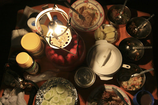
Dinner
Kevin: It was definitely nice to get some sun and to see some truly amazing views for once, let’s hope the sunshine lasts!
Beer: I felt much better that we got a dry afternoon and some great scenery of the mountains and the peaks around Chomolhari.
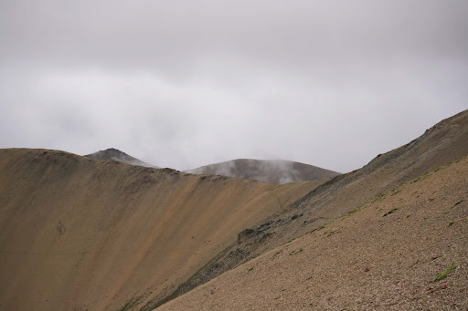
Day 6: Acclimatisation Day – Jangothang to Tshophu Lakes (4,390m):
5 hours | 15km | Altitude gain 340m | Altitude loss 340m |
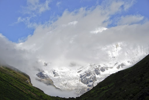
The weather held up overnight and it was a beautiful morning to have breakfast outside watching Chomolhari fade in and out from behind the clouds.
Chomolhari
Campsite in the morning
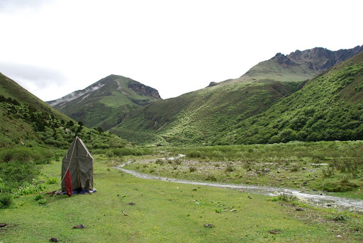
Our toilet tent
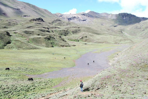
Heading towards Tshophu Lakes
Chenda making it up the path towards the valley
A view from the top of the valley
A view looking up into the valley
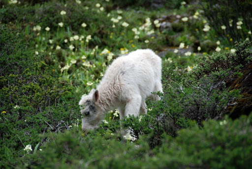
Baby yak in the valley
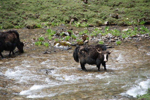
Big yak in the valley
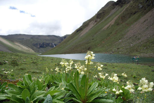
Flowers by Tshophu Lake
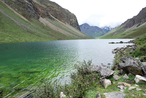
Tshophu Lake 1
Tshophu Lake 2
On the way back down looking down towards our camp
Back at camp
The caretaker of Jangothang
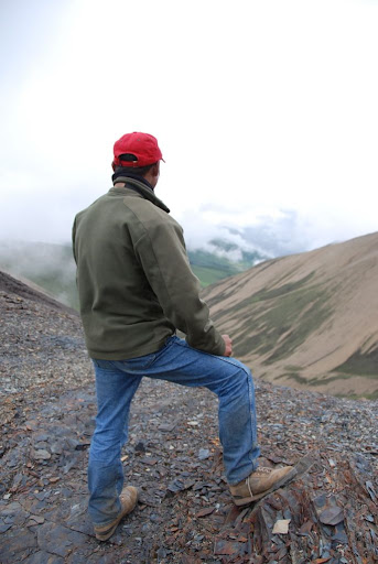
Chenda surveying the climb
We caught up with their guide the next day, who told us the two guys would zoom ahead and just wait for the horses and crew at their camp site later in the day – sometimes covering over 30km in a day.
Kevin: Compared to both groups of trekkers, we were at the bottom of the amateur scale and it was truly inspiring to see the determination some of these people had. This pushed me further to thinking that we were way out of our league this time around…
Beer: After the first few days, it is hard for me to contemplate how some people can enjoy trekking so much to come back and do a trek more than once. Having done the trek, I still cannot imagine myself doing it again. Don’t get me wrong, the views were amazing and the experience was very memorable. But for me, it was a “once in a life time” thing and remains so. At least that is how I see it for now anyway.
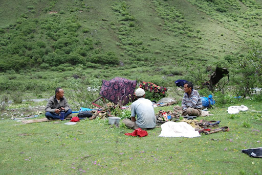
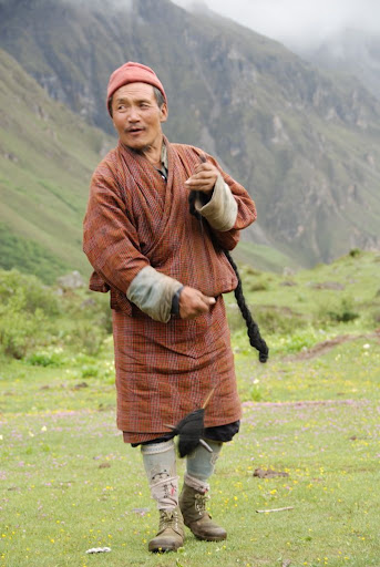
That evening, we hung out with our trekking crew and got a taste of traditional Bhutanese music courtesy of our multi-talented cook/driver/singer Phuntsho and we got a chance to talk about our families, cultures and religion.

Phuntsho, Sangay and Gembo
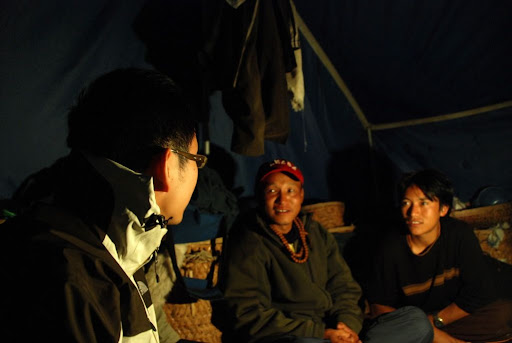
Beer in deep conversation with Chenda and Phuntsho
8 hours | 22km | Altitude gain 950m | Altitude loss 890m |
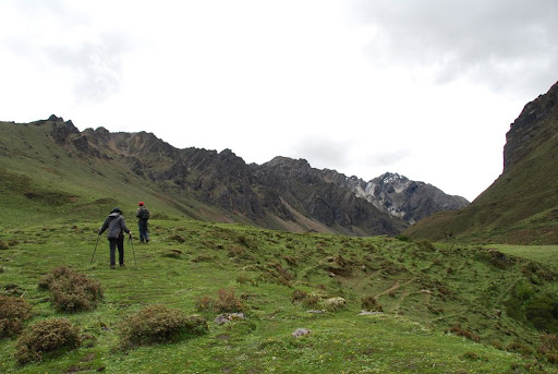
Another long day ahead, so we set off earlier than usual at around 8 a.m. Down the same valley that took us to the Tshophu Lakes, we passed the first bridge and after climbing the 2nd bridge, it was a steep 300m ascent to the plains where we would ascend another 200m gradually before reaching yet another steep climb.
On the way to Nyeli La pass
On the way to Nyeli La pass
At the top of Nyeli La peak

At the top of Nyeli La peak
From the top of Nyeli La pass looking South
From the top of Nyeli La pass looking North
From the top of Nyeli La pass
From there it was a short but steep descent through what we think is slate and granite rocks to our lunch spot (about 3-400m) down from the top of the pass. We found Sangay digging around for Cordyceps while waiting for us. Cordycep is actually a parasitic fungus which grows on caterpillar larvae and is used in traditional medicines in the Himalayan region as well as in China. They can be sold for a decent amount of money during the auctions and can sell for in excess of US$5,000 per kg.
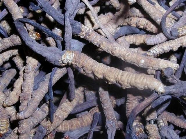
Cordyceps aka Caterpillar fungus (courtesy of alibaba.com)
Descending into Lingshi valley
Kevin: One of the most surreal experiences of the trek as the mist came over us – almost like Stephen King’s recent movie of the same title.
Lingshi valley mist
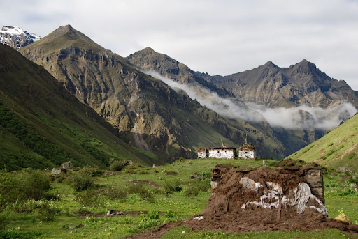
Beer and Sangay took the lead again and a steep descent to the Lingshi checkpoint brought them to a halt as they were unable to find a dry way across a rising stream to the small climb needed to get through the last hill to Lingshi valley. So the four of us hit the final short hike up the valley to get to our camp site about 1km up Lingshi valley with Lingshi Dzong in the distance.
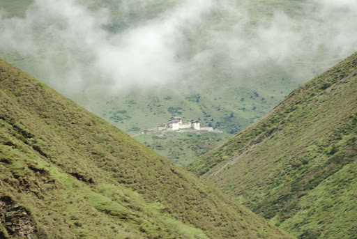
Lingshi Dzong
After trekking for the 5th day, we had reached our halfway point and were both getting somewhat used to the terrain and the routine by now.
Day 8: A Change in Plans – Lingshi to Babjee-Thang Valley via Nachuing La (5,080m):
8 hours | 17km | Altitude gain 30m | Altitude loss 400m |
The beauty of the trip started from this day. With this June bringing more rain than most years, Chenda had a big worry that if we had followed our original itinerary through Yeli La, down to Shodu, Barshong and finally Dolam Kencho, many of the lower bridges between Shodu and Barshong would be flooded over, meaning that we need to cross back over Yeli La (the way we had come) and retrace our steps back. Furthermore, neither Beer nor Kevin were big fans of the forest scenery and terrain from the first 2 days.
So Chenda suggested an alternative route which even he himself had not gone through before, taking us through Nachuing La, a double high pass which few Bhutanese, let alone foreigners had gone through. After getting some directions from the local yak herders, we set off up Lingshi Valley where Beer had a bit of a stomach issue and had to empty his bowels somewhere along the path about 20 minutes up the trail - in plain sight of all the yak herders nearby, while Kevin stood guard to ensure he did not get attacked by any stray yaks.
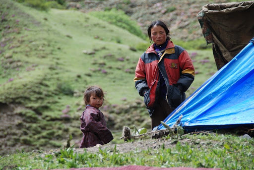
Yak herding family
Kevin ascending Lingshi Valley
Beer ascending Lingshi Valley
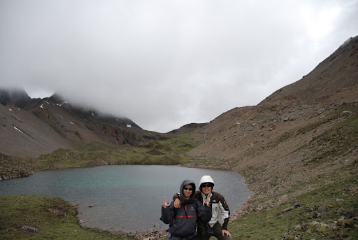
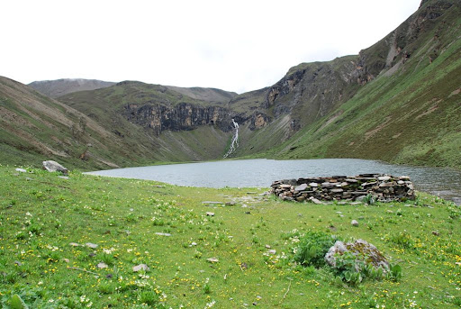
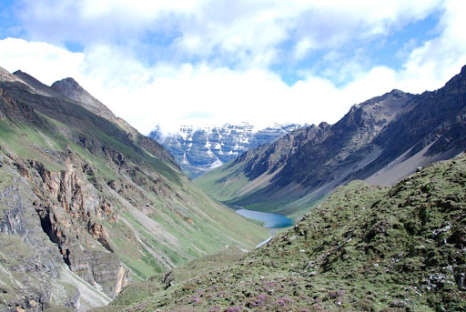
High altitude lake at Nachuing La (approximately 4,900m)
View of Golung Phu in the background
Beer: This was our highlight of our trek as we enjoyed some of the most beautiful views so far in this pristine valley, even though it was rather cold up here!
Kevin: We got to see Jichu Drake (6,900m) towards the East, the tip of Nam Nol to the West and the steepness of Bonte La to the South – where we would be headed the next morning.
Jichu Drake
View of valley

Peaks
Jichu Drake
The weather remained chilly and overcast for the rest of the day, but it was nice to be high up, breathing in the clean, crisp air and taking in the stunning scenery.
Kevin: After our 2 days at Jangothang seeing Chomolhari I and II, Jichu Drake and the vast valleys, I had not expected to see anything more spectacular, but the views today were almighty to say the least.
Beer: We were able to see one of Jichu Drake’s tips in all its might rising from the East; one of the clearest views of the mountains we had seen as of yet! As for the ealier headache, I suspect it must have been the wind blowing hard against my head that did it. After a quick nap, possibly the best sleep I had in the entire trip (hence the noise and the shake couldn’t wake me), I was back to normal.
That night, we braved the cold 2 degree Celsius weather inside the tent and struggled to hold off on the toilet breaks until the morning so we didn’t have to go outside.
Day 9: Beauty in the Valley – Babjee-Thang Valley to Soi Yakse Valley via Bonte La (4,920m):
9 hours | 20km | Altitude gain 720m | Altitude loss 1,000m |
View looking up the valley from our tent
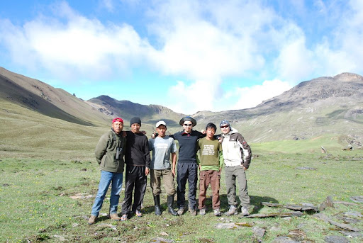
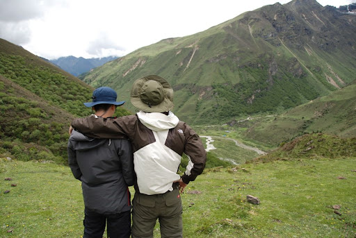
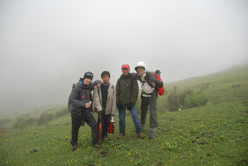
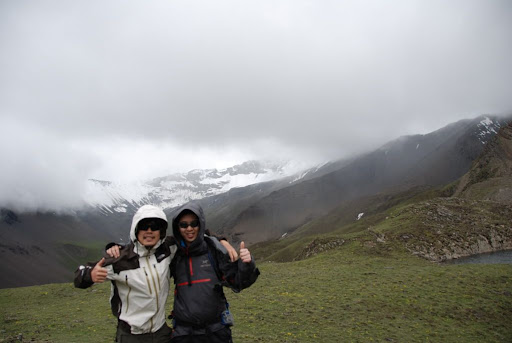
The group photo!
View towards Bonte La
On the way up, we stopped to see a yak herder’s huge collection of Cordyceps:
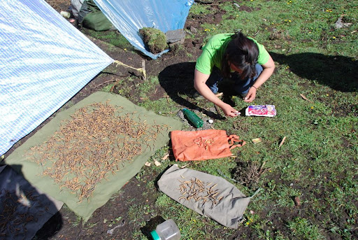
Cordyceps lady

View of valley

Nam Nol
Passing Tshophu Lakes from the other side once again
Climbing Bonte La
At the top of Bonte La
Chenda, Beer and Phuntsho higher up in the valley surveying the surroundings
Final view of Nam Nol
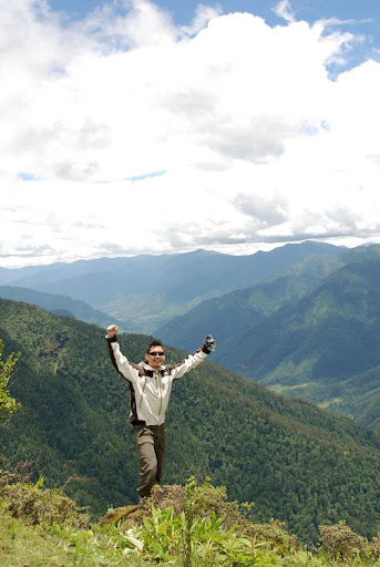
Kevin: The past few days have been extremely nice to us as we traversed these high passes and each turn we came around seemed to present something even more amazing than the previous view. The views on this part of the trek have been incomparable to anything I have seen in my lifetime and no photos of any kind could capture the breathtaking surrealism here.
Beer: With the weather having held up for the past 3 days (bar the short bout of rain as we went through Nachuing La), I was enjoying the trek a lot more at this point. This combined with the sensational views of the past few days put me in good spirits. Since our firs day in Bhutan, I prayed every night before I went to bed but I didn’t actually ask for anything at the end of it. I started asking for better weather after day 3 of the trek and since then the weather has been great! Amazing stuff.
We could see the “final” trail up to Gen Tsa as early as we descended from Bonte La and it seemed so treacherously steep and long. We weren’t sure if it was just purely adrenaline driven or not, but the actual climb up that last stretch turned out not to be too bad in the end.
Day 10: Another Double Pass – Gen Tsa to Gunitsawa via Taglung La and Thombu La (4,480m):
8 hours | 18km | Altitude gain 700m | Altidude loss 1,950m |
From Gen Tsa
The climb up through Taglung La (4,580m), followed by a descent into Thangbue Valley (4,080m) and a subsequent climb to Thombu La (4,290m) turned out to be less insane than it had sounded the night before. Beer managed to make good speed, especially going up Thombu La and ended at the top about 15 minutes before anyone else came along. Kevin then decided to show he isn’t all that slow by traversing quickly after Thombu La, with the vision of reaching Gunitsawa camp coming across his mind.
Thangbue Valley
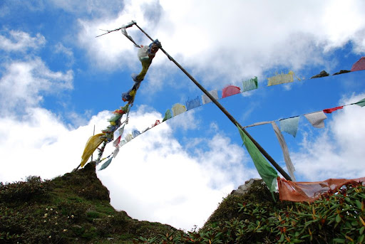
Prayer flags at the top of Thombu La
Beer at edge of cliff

Valley
Beer: We were finally back at our starting point! This meant warmer nights, but unfortunately an insane number of insects. We were so worn out by now though!... and finally a much needed break for my knees and back!
Kevin: My gas tank was definitely on empty by now and the engine and oil was in major need of servicing! It was definitely good to be back to Gunitsawa though.
It was here we both realised that we had succeeded in finishing the trek and we both felt a great sense of achievement in doing something which we had never done before and completely outside our usual comfort zone. We really had to push ourselves hard and tested our limits and, as a result, we are now stronger, physically and mentally.
While Kevin managed to send a text message out a little earlier before we began to descend, there was unfortunately a lack of phone reception in the Gunitsawa valley area. The two of us went North for about 15 minutes and then South towards Drukgyel Dzong for a good 10 minutes but did not manage to get any signal.
Day 11: The End is Finally Here – Gunitsawa to Drukgyel Dzong to Thimphu (2,850m):
4.5 hours | 15km | Altitude gain 0m | Altitude loss 300m |
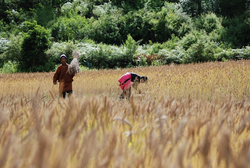
The morning took us on a half day walk back to our starting point Drukgyel Dzong, passing through the village shops, rice fields and through a few muddy paths on the hottest day yet.
Rice fields
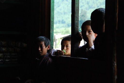
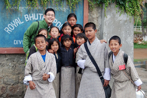
School kids in village
Kids in village shop
Beer: Unlike Kevin, I managed to stay unburned for the entire trek.. until this last day... Kevin told me that it was only going to be a short walk (even though I remembered differently and told him otherwise, he sounded so sure and convinced that he was right!) so I didn’t put on my sunblock... a few hours later my arms and nose were burned!
Kevin: By this time, I think I was mildly hallucinating at how close the finish line was, but even with this in mind, I was not going to risk getting fried (yet again) by the sun and was pretty much completely covered up by this point.
School kids with old lady
We were reunited with our driver Leki, who took us from Drukgyel Dzong to the capital city of Thimphu which took a good 1.5 hour over a distance of 80km drive.

Our car
Kevin: A friend of mine had already told me that Thimphu was a bit of a drab place with little to offer and she was right. I think the city loses some of its more traditional cultural aspects compared to Paro and some of the other towns we passed through on the way here.
After we checked in at the hotel Druk Sherig, we got a heartily prepared lunch consisting of a piping hot grilled cheese sandwich and some rather strange tasting French fries followed by something we had been waiting for the past week and half – a shower!
Kevin: My 1st shower in 10 days came pretty high on the list of the best experiences in my life.
Beer: The best three hair washes and half a liter of soap ever! What a wonderful feeling!
After we cleaned off 10 days of grime and the road kill which had become of our hair, we made a trip to the local internet café where Beer had a few headaches as he struggled to get past the 56k connection and past the google.com homepage and since we were extremely sore after finishing the trek, we thought it would be a good idea to find a place to get a massage from. Chenda was kind enough to suggest a local fitness center which unfortunately didn’t have what we were looking for. A quick call to the Aman Resort in Thimphu yielded nothing either as their spa was under renovation that day.
As we decided to do most of the sightseeing the next morning, we had a couple of hours to explore the city and take a good long walk from one end of Thimphu to the other:
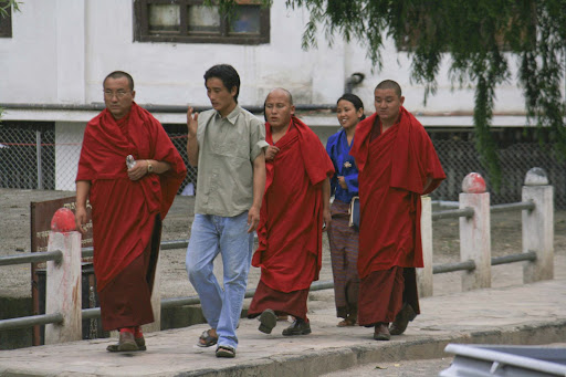
Monks on the streets of Thimphu
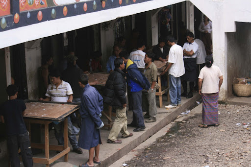
Finger billiards
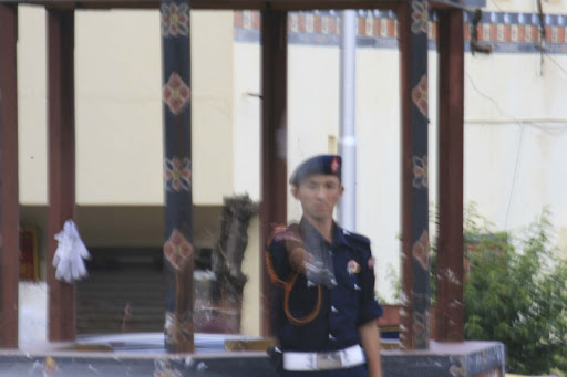
Policeman directing traffic
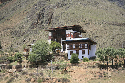
Photo of temple
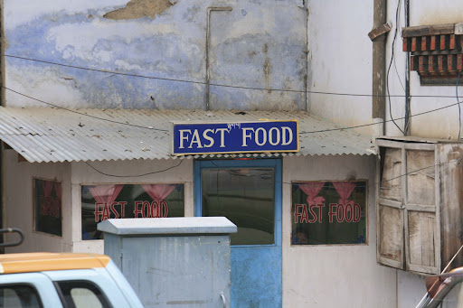
"Fast Food"
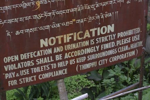
Defacation sign - unfortunately one of the rules which Beer failed to follow twice
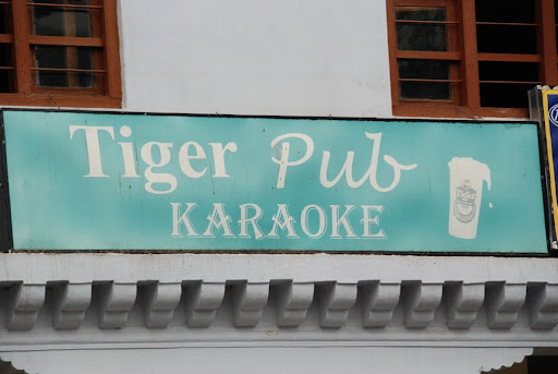
Tiger Pub
We followed the beers up with some Johnnie Walker’s Green Label which seemed alright, but the killer came in the form of the ‘martini’. It all started when Beer brought up the idea of getting some food with our drinks and Kevin saw a stash of olives behind the bar. Even at US$1.5 each, it failed to trigger any form of suspicion on our part and a quick sip of the potent drink had both of us almost keeling – not because it was strong, but because it was so, so disgusting. Kevin imagined this to drinking a collective cup of armpit sweat. Nonetheless, it was fun and interesting to get a taste of Bhutanese nightlife (albeit at 5 p.m. in the afternoon).
Beer: mind you, we heard some serious pumping music outside when we were trying to get some sleep later that night. I suspect all that must have been from Tiger Pub. Although not exactly the world’s greatest pub, I still want to say this: Tiger Pub for the win!Kevin: I just couldn’t stop wondering if things would be similar to the Tiger Pub MTV, but I guess it will have to wait until next time for us to find out!
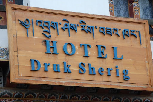
Our hotel - the Hotel Druk Sherig
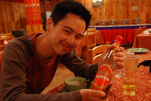
Kevin with the Druk 11000
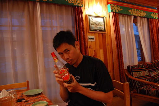
Beer with the Druk 11000
The next morning, our multi-talented chef turned driver Phuntsho took over from Leki and we had the opportunity to visit some of the key sights of Thimphu. Making our first stop at the National Arts School where we got a glimpse of art students sculpting deity figurines and the intricate weaving of a gho or kira, the national clothing of Bhutan. This weaving procedure is said to take up to six months for the more sophisticated patterns.
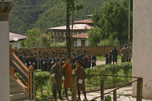
Art students finishing their prayers in the courtyard before exams

Sculpturing
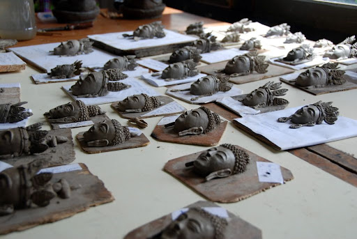
Sculptures
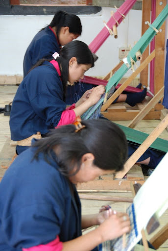
Weaving

The Folk Heritage Museum
Thimphu main street

Taxi central
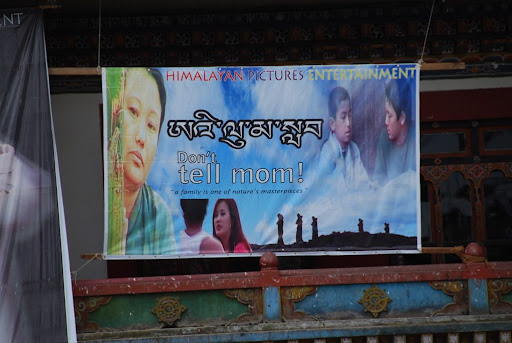
Bhutanese blockbuster
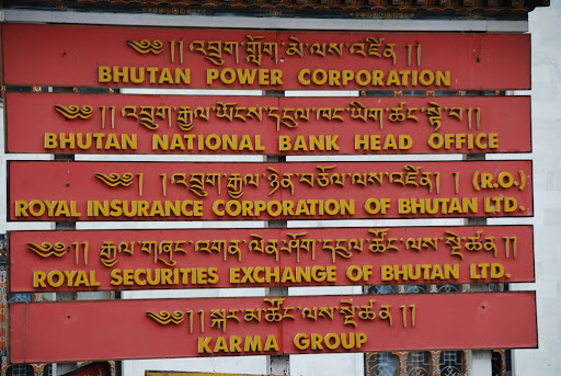
Major financial and government institutions all in one
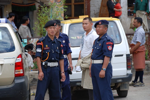
The police
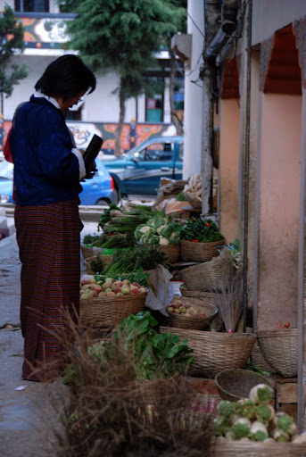
Vegetable and fruit market on the side streets of Thimphu
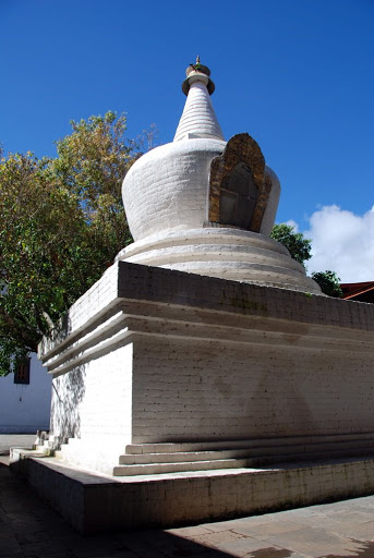
After about an hour from Thimphu, we reached the Dochu La pass (3,150m) and the 108 stupas/chortens amidst some hazy, foggy skies. On a clear day we could have been able to see some of the high peaks of Tiger Mountain and Masang Gang.
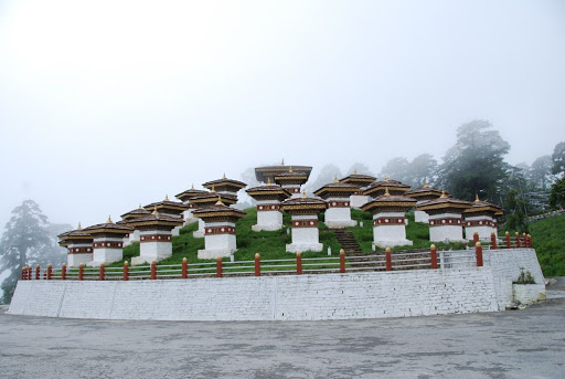
108 stupas at Dochu La
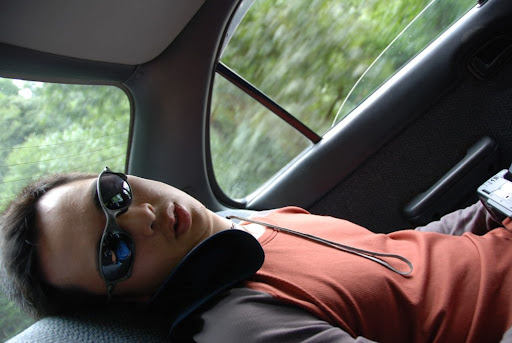
Kevin passed out in the car on the way to Punakha
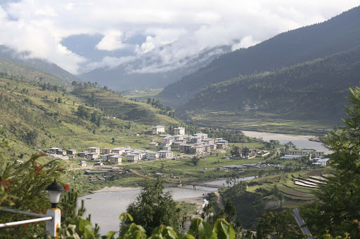
Punakha Valley
Meri Puensum

Looking into Punakha Valley
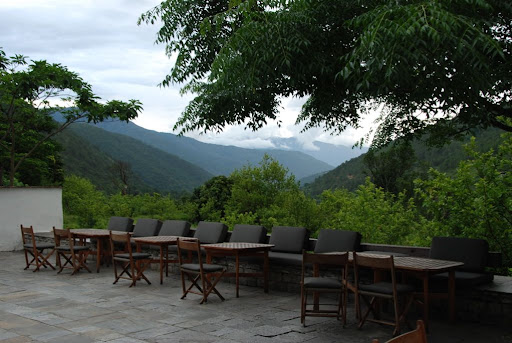
Amankora Punakha
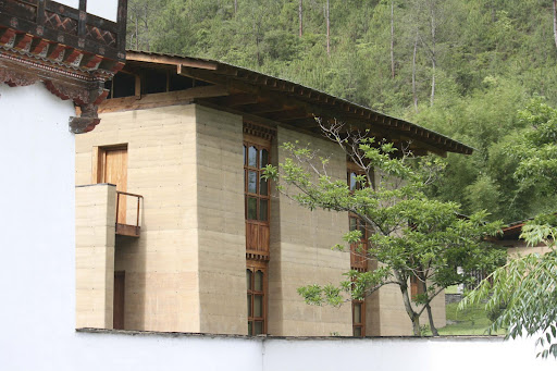
Amankora Punakha
Kevin: When we got there, Beer went for his massage first, so I got a guided tour of the resort. They managed to keep the architecture unobtrusive while making the interiors very simple and modern which was nice. After my tour, I had some time to kill, and the 30 minutes spent sitting in the steam room at the spa was just pure bliss.
Beer: the massage was great. One of the masseuses told me that the “president of Thailand” stayed there the previous year and that he gave him a massage. Presumably he meant “prime minister of Thailand”. Anyway, Kevin and I both agreed that hotel’s rate of US$1,000 a night is way too much for what it is.
Expensive? Having reached the end of our long journey, the US$60/hour for the massage didn’t seem so bad after all, and it was superb!
We arrived back at the pick up point two and a half hours later and saw Phuntsho and Chenda examining our front tires. We didn’t stop to ask about it, but once on the car, it turned out that the screws which were holding the front wheel together were fast coming undone. We had already lost 1 out of 4 screws coming down from Dochu La, and the 2nd one was just about to go.
The usual 15 minute drive back to the hotel took a good 40 minutes as Phuntsho prodded the car along at about 20km/h to make sure the wheels lasted until we got back safely. A little later that night, our replacement car and Tschung (our new driver) arrived as Phuntsho had to tend to our wounded car and would have to stay behind in Thimphu the following day.

Hotel Bar
Our guide Chenda
Beer and Phuntsho taking it easy
Kevin chilling out
After dinner, we thought it would be nice to chill out with Chenda and Phuntsho outside and take in the crisp air of the night. Unfortunately, the longer we sat, the more unwanted visitors seemed to stop by and suddenly, after our first beer each, a huge hard shelled beetle (about the size of our palm) made a crash landing smack in the middle of the pagoda area.
Beer: I actually saw it fly into a pillar before knocking its own lights out!
Kevin: By now, I was paranoid that it would have friends lurking behind me on the sofa...
Chenda and Phuntsho were completely unfazed by the bugs, but after sitting around for another 10 minutes or so, we decided to call it a night and headed back to (what we thought) was the safety of our rooms.
Kevin: It must have been the most uncomfortable and sleepless night I have had on the entire trip as I got bitten at least 15-20 times that night and ended up sleeping with a towel over my face to keep bugs away.
Beer: I think the gnats and mosquitoes were just sitting there and waiting under our sheets all night and struck when we were most vulnerable. Shorts and t-shirt was definitely not the way to go here.
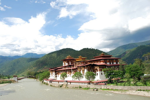
Day 13: Punakha to Paro (2,500m):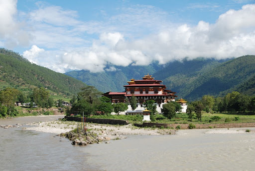
Punakha Dzong
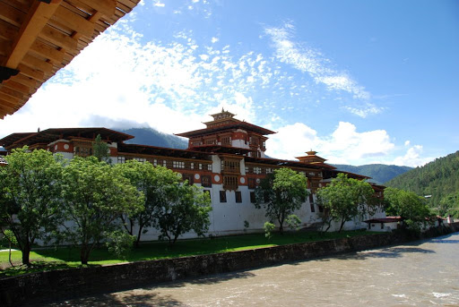
Punakha Dzong
Chorten in Punakha
Bridge at Punakha Dzong
Bridge at Punakha Dzong
Bridge at Punakha Dzong
At Punakha Dzong

Inside Punakha Dzong
Monks
Pillars
Monk guarding shrine
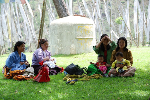
The children who are born as a result of their mothers’ visiting the temple come back to Chimi Lhakhang every year to give their thanks and receive their blessings from the temple and to show how important of a monument the temple is, during the 20 odd minutes we spent at the temple, we must have seen at least 15-20 groups of couples, families and mothers wielding their newborns coming to get the blessing from the Devine Madman.
Before we left the temple, we were offered some holy water which was yellow in colour. Chenda and Beer both drank it respectfully while Kevin seemed to have imagined it to be something different and refused to drink it! (Although Chenda did say that putting it over your head was ok too)
Chimi Lhakhang

Village Restaurant
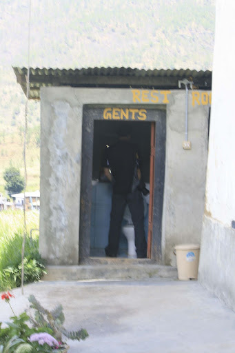
Public Urination
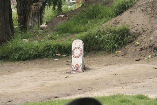
Archery Target

Archers
Day 14: Paro to Bangkok:
After two epic weeks in Bhutan, it was indeed time to say farewell to the beautiful country and head back to civilisation. Our flight departed at 9 a.m., so we had an early 6:30 a.m. breakfast of scrambled eggs and toast before our short 15 minute drive to Paro Airport.
We caught up with Bob and Kuzo (the two speedy trekkers on the Laya Gasa trek) at the terminal and on the plane as they were heading back to Bangkok for a quick transit back to Hong Kong. Bob told us that they had a successful run to Gasa and finished in their expected time; they definitely have our respect!
Paro Airport Departures
We finally took off at 9:30 a.m. and made a landing into Suvarnbhumi Airport (which is recently voted the forth best airport in the world!) at 3 p.m. local time after a short stop in Calcutta, India. It was time for Kevin and Beer to part ways…
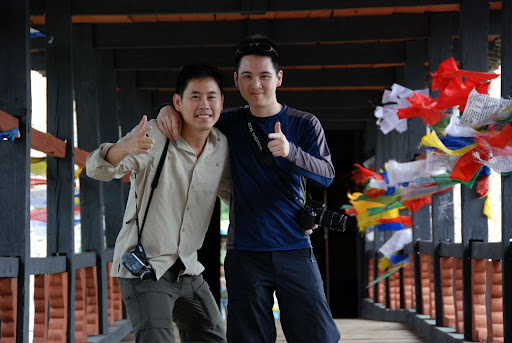
Kevin: We’ve been good friends since English Literature classes at Charterhouse over 14 years ago and I can think of few people to go on such an epic journey to the remote mountains of the Himalayas with. I think we kept each other somewhat sane during the tougher parts of the trek and I look forward to doing another epic trip with Beer again next year.
Beer: During the flight to Bhutan, I told Kevin that since this was going to be a tough journey there may be times that we may get into arguments (as people do in hard time) and that we should try and stay out of that sort of situation. I’m glad that we didn’t actually get into any argument during the 9 days trek. Like Kevin said, we kept each other sane and made the other laughed when he needed it... although you should really see Kevin in action when he was walking up the hills / high passes... he is so fast, I’m telling ya.
The End
1-10 (10 being most) | Kevin | Beer |
Challenging | 10 | 10 |
Epic-ness | 12 | 10 |
Achievement | 10 | 10 |
Weather | 6 | 6 |
Views/Scenery | 10 | 10 |
Overall Enjoyment | 8.5 | 8 - 9 |
Feel free to drop us an email if you are looking for high res photos or to get more info on Bhutan trekking. Alternatively, the trekking company which we used is Bhutan Travelers. We had a great experience both pre and post the trip and would recommend Bhutan Travelers for anyone interested in doing a trip to Bhutan - Karma Tashi and his team were extremely informative and the logistics were as smooth as we could possibly expect.
5 comments:
Kevin and Beer - this is amazing! Sounds like a real challenge and life changing experience...so congratulations for completing it!
Love the pictures of Jichu Drake and Tshopsu Lake... please send 2-3 good ones to me... I can set it as my wallpaper at home. =)
Hope all is well...
With love from london
Pat
Congratulations for completing the trip. Can you help me choosing which treks to choose for a beginner? I plan to go somewhere in December.
Simply magnificent!
Hi kelvin and beer thanks for posting all your experience over here i really enjoyed your post and pic are very beautiful. Waiting for
your next tour.
you may also visit our website.
Bhutan Tour.
Thank you
Amazing Post, Thanks to share wonderful information about Bhutan Trekking.
Bhutan Trekking
Post a Comment